- Home
- /
- Gravel Adventure Field Guide
- /
- Saguache
Situated at the north end of the valley, Saguache was one of the last areas to see permanent settlement. The name refers to a Ute camp found there as Euro-American traders and trappers passed through on the Old Spanish Trail. Farming of wheat, hay, vegetables, and grazing of cattle and sheep quickly took hold after Otto Mears opened a store and brought the first mover, reaper, and threshing machine into the valley in 1866. He later gained road building notoriety by connecting Saguache (Route 285) over Poncha Pass. Today the town boasts a number of historical buildings and access to the Rio Grande National Forest, BLM, and extensive unpaved road network of Saguache County.
Routes
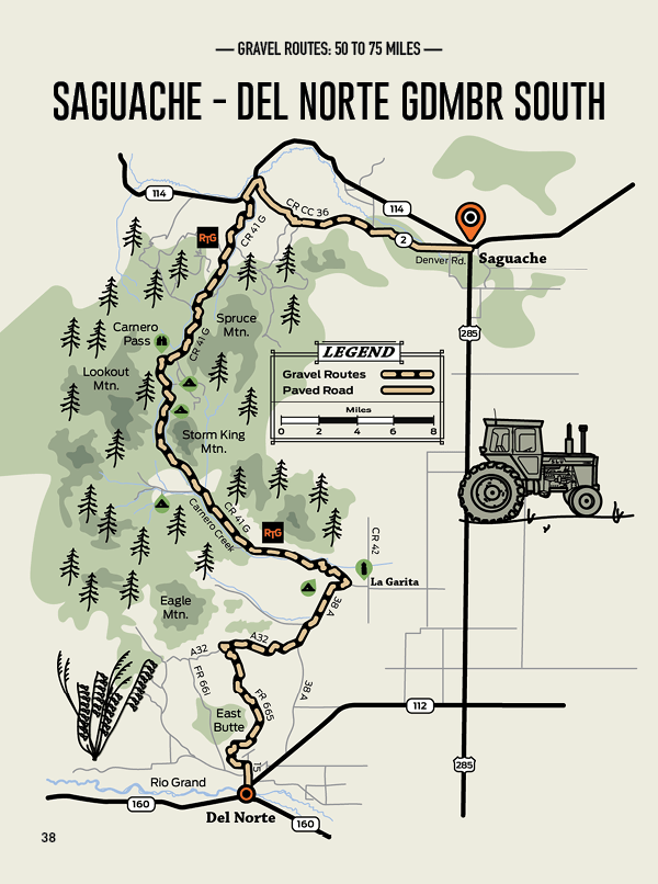
Saguache – Del Norte GDMBR South
Distance: 62 Miles
Elevation: +4,004 Ft
Max Grade: 9%
Approx: 82/18 %Gravel/Paved
This one can be ridden in different ways. One way, or out and back. One or multi-day. How to tackle the Great Divide Mountain Bike Route between Saguache and Del Norte is up to you. Simply know it’s a challenge on a gravel bike. Segments include sand and sharp rock requiring 40 mm+ tires.
Created by the Adventure Cycling Association in the 1990s, GDBR extends from the Canadian to Mexican border. Leaving from Saquache you’ll make two climbs to an elevation of 10,164 ft. Strands of aspen, wildflowers, and views laden with remnants of SLV’s volcanic past are everywhere. For those traveling with a fishing pole, the Carnero Creek (Sheep in Spanish) will be of interest. Beautiful and rare cutthroat trout can be found.
This is a fantastic SLV segment of the GDBR for adventure riding or endurance training. You do you.
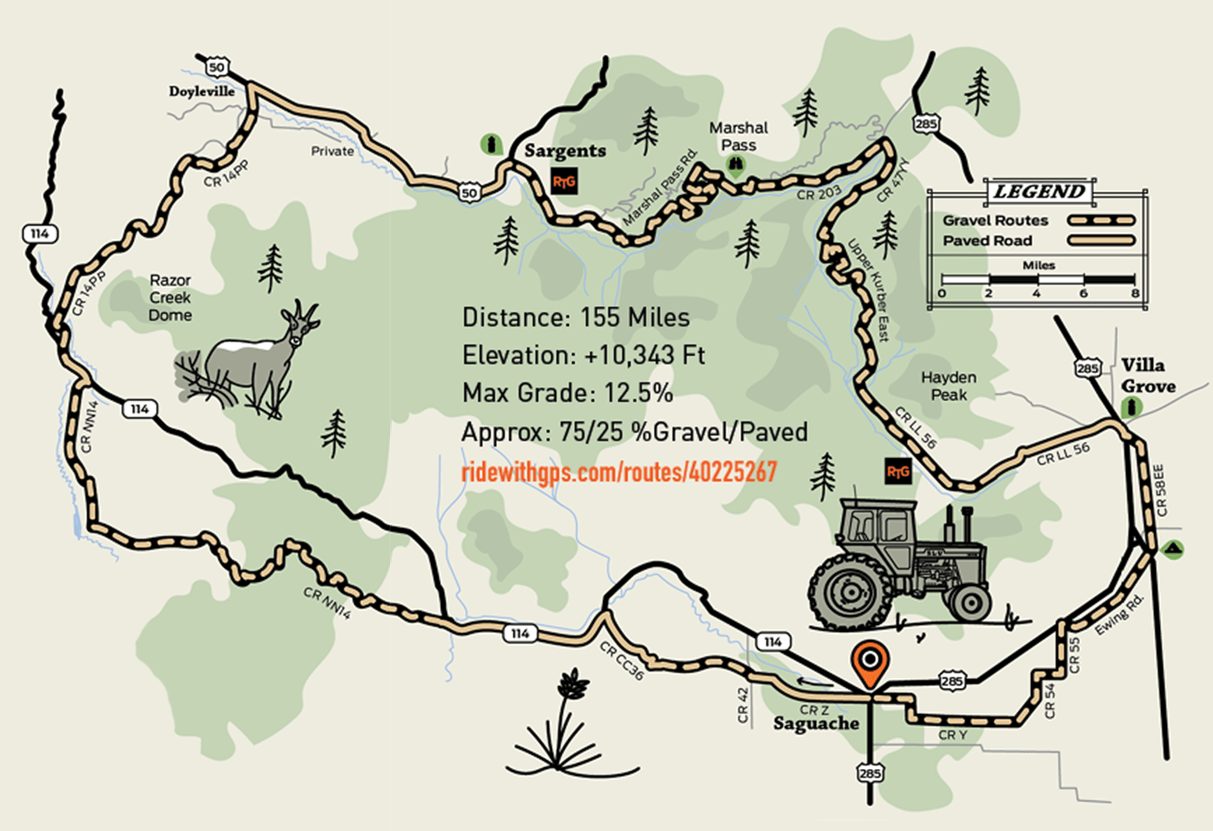
Great Divide Overland North
Distance: 155 Miles
Elevation: +10,343 Ft
Max Grade: 12.5%
Approx: 75/25 %Gravel/Paved
This route is intended to be a multi-day bikepacking excursion that allows you to camp or stay in cabins along the way. It will also follow the northern segment of the GDMBR but return to the valley from Sargents to Villa Grove in Saguache County.
You’ll travel over Cochetopa Pass, which was used by Ute tribes to travel to and from the SLV. Cochetopa translates as “pass of the buffalo” and the surrounding hills were traditional hunting grounds. Public land in this area provides the first camping opportunity.
There are eight miles of pavement in the approach to Sargents on Highway 50, one of the few segments of pavement on the route. The town affords the chance to overnight and obtain needed food and water supplies. Be prepared for big climbs before returning towards Villa Grove. Don’t be afraid to take advantage of the hot springs before riding into Saguache.