- Home
- /
- Gravel Adventure Field Guide
- /
- Del Norte
Del Norte’s name was inspired by its location, where the Rio Grande del Norte, ‘large river of the north’ flows into the San Luis Valley. The area was first inhabited by Ute tribes in warmer months seeking wild game, plants, water, and timber, with Spain and Mexico following suit. Land grants issued by Mexico encouraged settlement, but this proved difficult as Utes fought to preserve their sovereignty. After the U.S.- Mexican War, Euro-American migration accelerated and the town was formed In 1871. Del Norte quickly grew as a supply station for freighters and miners from the East Coast and Europe. Now, it’s a gateway for gravel cyclists to access the unpaved roads and trails of the Rio Grande National Forest, and the renowned Continental Divide Bike Route.
Routes
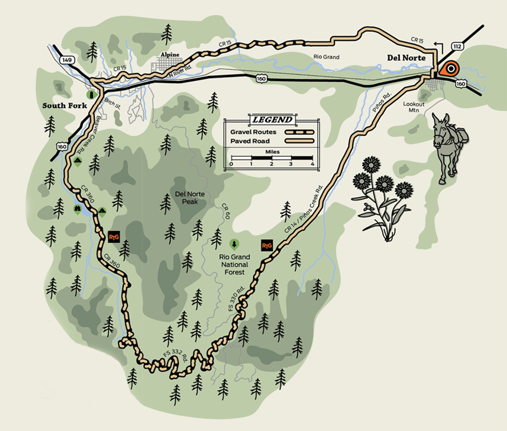
Rio Grande Traverse
Distance: 66 Miles
Elevation: +4769 Ft
Max Grade: 10.9%
Approx: 54/46 %Gravel/Paved
This route starts by following the contours of the Rio Grande River between Del Norte and South Fork. South Fork serves as a stage stop for travelers passing through. Cyclists are encouraged to take advantage of amenities here to prepare for the long ride.
South of Highway 160, the ascent to 11,519 ft through the Rio Grande National Forest begins. The roads here are directly related to the 19th century mining and timber industries. 1870 gold and silver discoveries in the San Juan Mountains drew an influx of prospectors. Conservation efforts began in 1905, when President Theodore Roosevelt established the San Juan Forest Preserve after demand for timber increased.
The route is very suitable for bikepacking if you’d like to make it a multi-day outing. A number of campgrounds are accessible along Beaver Creek.