- Home
- /
- Gravel Adventure Field Guide
- /
- Creede
Historic Creede is the one, and only, town in Mineral County. Despite a small population (>300), it possesses extraordinary Colorado history. Situated at the end of a box canyon and the headwaters of the Rio Grande del Norte, the hanging cliffs above town makes this a unique SLV stop. One visit, and you’ll see why it was chosen as a shooting location for the 2013 Lone Ranger film. At one time, Creede was home to as many as 10,000 people seeking fortune and fame, including criminal underworld and outlaw personalities like Robert Ford, best known as the man who killed Jesse James. However, it all came to an end with the Silver Panic of 1893, which led to a U.S. economic depression until 1897. The current gravel bike boom has given people a new reason to visit this stunning place on the map.
Routes
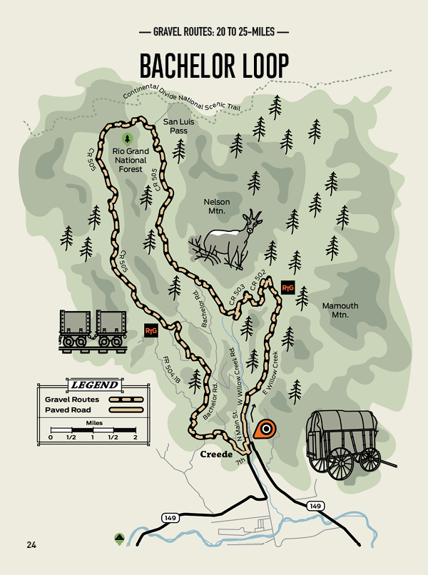
Bachelor Loop
Distance: 25 Miles
Elevation: +4,549 Ft
Max Grade: 21%
Approx: 94/6 %Gravel/Paved
An iconic off-road route that begins and ends in the town of Creede. After climbing the steeper East Willow Creek portion, the hard effort pays off with a fun descent down the West Willow Creek. The original Creede townsite sat at the junction of the two creeks. It was named after Nicholas Creede, who discovered the lead, zinc, and silver deposits of Holy Moses Mine in 1889.
This is a high elevation ride, rarely dipping below 10,000 ft, with a high point of 12,518 ft. It affords great views of the town and Rio Grande River Valley. It’s not out of the question to catch glimpses of wildlife, including mule deer and moose. If you’re not in a hurry, there are interpretive stops along the way to further learn about the area’s mining history.